Itinerary
It is a linear path within the itinerary of the Great Path of Malaga as stage 3. On the way we will cross part of the municipality of Ronda, including the neighborhoods of Los Prados and La Cimada.
Paths that link:
- Link with SL-a 274 Cerro de Sabora.
- Coincidence with the PR-A 419 Las Carboneras for 2.6 km
- At the end of the Stage, link with the PR-A 250 De Arriate a Ronda and the GR 7 E4.
Summary
This longest stage of the Alternative Route 249.5, at twice the length of the others is quite physically demanding, and on top of this is the accumulated elevation gain and loss.
The first 7 kilometres, while crossing the Padrastro and Padrastrillo mountain ranges are the hardest part, on uneven mountain paths and through some relatively solitary spots. This includes the climb to this Alternative’s highest point, at 945 metres above sea level. Heading largely west, it soon reaches the Cańete la Real Railway Station, which was a large country estate until the end of the 19th century. La Atalaya, where the route changes direction, has not only traditionally been a crossroads for travellers, but also the natural meeting point of Malaga’s mountains and the Andalusian flat countryside. It also follows the upper course of the River Corbones, which originates here. This is actually, a tributary of the Guadalquivir, the great river artery in the Carmona area.
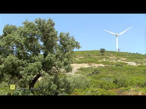
The rest of the path heads south-west and links together a series of extensive plains, utilised as either undulating meadows for grazing or the cultivation of cereals. In between these, are pathways shrouded by woodland or through deep-seated valleys. These consecutive and wide-open plains are Cuatro Mojones, El Borbollón (and La Capellanķa), Zaharilla and La Alberca. They appear on both sides of the route, which often runs along the boundary between the forest and the farmland. Each of these are crossed by numerous Vķas Pecuarias (Livestock tracks), which were used to manage the extensive livestock of some of the best pastures in the province of Malaga.
The railway line was built down this Majamoclón Valley in the mountains of Los Borbollos, and runs alongside the route for many kilometres. The last section is naturally the most influenced by human life. In the small valley that begins at El Monte pass, the fertile soils and the diverse environments have led to the large number of farms and country estates dedicated to agriculture.
These eventually and only relatively recently brought about the two settlements in Ronda’s backyard, Los Prados and La Cimada. These are, in reality more closely linked to Arriate, which is right next door and brings the Stage to a close.
The best
In Cańete la Real stands out the Hins Canit Castle, built in the ninth century by the Arabs commanded by Wasaya ibn al-Khalķ, was part of the defensive belt of the rebel Omar Ibn Hafsun against the Andalusian caliphate. Apart from several churches and the Nasrid bridge of Ortegķcar and the farmhouse tower, in Cańete the forest mass of the repopulation pine forests in the area of Las Carboneras and the pine forests of Ortegķcar stands out. In the western area, the pastures of holm oaks near the hamlet of the Watchtower stand out.
In Arriate, the Church of San Juan de Laterįn stands out, which dates from the seventeenth century and inside the Mudejar armor roof made by Francisco Hernįndez and Andrés Valverde in 1629 stands out. From the point of view of nature, point out the Gorge of the Ventilla stream, a natural space of great beauty located in the vicinity of the urban center and which can be reached by an enabled path.