Itinerary
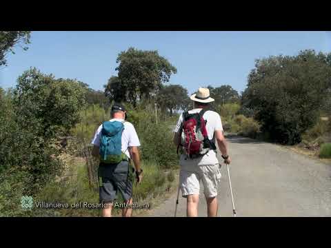
The first section of the variant runs along the bank of the Guadalhorce River. It is a stretch of medium difficulty and not very long. During a part of the tour, the vegetation of riverbank, poplars, willows and ash trees, mainly, together with the flow of the water, will bring us freshness and shade. Very interesting the views that the hiker has when approaching Antequera.
Paths that link
- Coincidence up to km 2.0 with Stage 12 of the GR 249 Gran Senda de Mįlaga
- Coincidence with the GR-248 Gran Senda del Guadalhorce up to km 6.5
- Derivation for Wildlife Observation at km 6.5
- Coincidence with the GR 7 E 4 between km 21.3 (road A-7075) and the Birth of the Villa (km 22.4)
- Partial coincidence with the SL-A 22 La Escaleruela km 22.4.
Summary
Variante 249.4: This long, three-stage Alternative begins in Villanueva del Rosario and connects Stages 12 and 21 of the Great Malaga Path, passing through Antequera and the Abdalajķs Valley. The general direction is south-west and is some 67 kilometres long in total. In terms of its geography, it runs along the top of the River Guadalhorce’s catchment area, and negotiates the obstacles of Antequera’s Torcal and the mountain range of La Chimenea through the mountain pass. Malaga’s longest river also accompanies it close to El Chorro, downstream from the Caminito del Rey gorge walk.
Stage 1 of this Alternative links Villanueva del Rosario with Antequera in a Z-shaped route that begins and ends in a north-westerly direction with the longest section running east to west. This part of the province of Malaga is surprisingly mountainous, with the Path following a winding route along the northern slopes of the Central Limestone Arc. During a very important part of the route however, you join traditional country paths along the banks of rivers or streams. The rest is through undulating semi-mountainous terrain, high up above the watercourses flowing year-round. Therefore, from the Platero country estate onwards, the route’s profile shows a continuous but very gentle ascent, gaining 150 metres in elevation over 7 kilometres. It then continues along the mountain range’s teeth-like profile until Antequera, where it descends again quite steeply.
Perhaps the route’s most appealing part is its passage through the Public Uplands of La Alhajuela – Cortijo Guerrero and its surrounding areas. This extensive area of gypsum, marl and clay hills creates some quite spectacular landscapes of rolling hills, with aromatic shrubs and reforested areas of conifers. This impermeable rock, found under the limestone of the sierras, causes some considerable springs such as the famous one at (Nacimiento de) La Villa.
The municipal areas of the town and the city that are home to El Torcal do not have such a long history, as implied by the name Villanueva (meaning New Town), which gained independence from Archidona in the 16th century. Its boundary runs along the banks of the Guadalhorce and the road finally enters Antequera’s land at kilometre 7.
The best
The first section of the variant runs along the bank of the Guadalhorce River. Apart from that, in Villanueva del Rosario stand out the parish church and hermitage (in honor of the Virgin of the same name), the Old Fountain and the exhibition of engravings by José Hernįndez (National Prize of Fine Arts in 1981), favorite son of the municipality, located in the House of Culture. Villanueva del Rosario is located at the foot of the Sierra de Camarolos, declared a Special Conservation Zone (ZEC), a space of great geological and biological richness. Villanueva del Rosario is a true paradise for climbers and in its mountains it has some of the most difficult roads in the world. Some of them are so famous that they even have proper names such as the Chilam Balam or the Shiva Plant.
Antequera has one of the largest concentrations of churches in all of Spain (about 30 temples in the urban center) of different architectural styles (gothic and baroque to date). Alongside them, it is worth highlighting its archaeological heritage, among which stand out the Dolmens of Menga, Viera and Romeral, declared World Heritage. Its historic center is also worth a visit with a good number of manor houses and mansions that are integrated into an architectural complex declared a Historic-Artistic Site. Highlights include the Alcazaba, the Palace of Nįjera (City Museum), the Royal Collegiate Church of Santa Marķa La Mayor.