Itinerary
The tunnels in Rincón de la Victoria are a perfect spot for the beginning of the path that, on one side, goes along sandy beaches, and on the other, follows inland trails among fields and reedbeds in the presence of recognizable watchtowers.
Summary
La Axarquķa’s coastline begins directly to the east of the provincial capital and differsin landscape to that of the western. Although it is less densely populated by comparison, the appealing climate and the abrupt and mountainous terrain means the development is more concentrated closer to the coast. Mountain ridges stretch all the way to the sea, creating cliffs and crags that become an obstacle for hikers or, in the case of El Cantal, the main attraction of the area.
Stage 2 starts where the municipality of Rincón de la Victoria and its towns begin, from La Cala del Moral to Torre de Benagalbón. It continues along the Vélez-Mįlaga coastline (Chilches&Benajarafe) and then heads progressively inland to meander its way through the slate and chalk schist ridges. Passing by the outcrop, El Peńón de Almayate, it ends up on the fertile plains of the River Vélez. For the most part, the route follows an east-west line, coinciding with the N-340, just as The Great Malaga Path does on a number of occasions. The trail then heads north, following the River Vélez.
The GR-249 is designed to guide you in an easterly direction along the seafront boulevards, footpaths, tracks, sandy beaches, pedestrian walkways and roadsides. This diversity of the route plays a large part in the attractiveness of the stage, with its constant changes in trail surface, distance from and thus relation to the beaches and ultimately the landscape.
The Great Malaga Path is overflowing with History, with a capital ‘H’ thanks to its Phoenician settlements, Roman villas and factories, Arabic farmhouses, medieval watchtowers, 18th century forts and quarries connected by age-old tracks that inevitably became railroads.
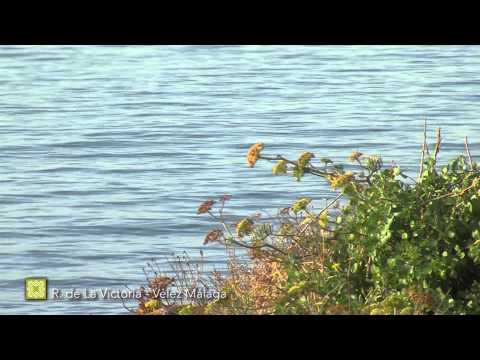
Nature modestly survives on the sea cliffs and boundaries of the wider beaches in the form of attractive coastal plants. Pockets of rural and agrarian life prevail in the form of traditional irrigated crops on the flood plains of the River Vélez, land previously used to produce cane sugar for the refineries and sugar mills.
The best
The east coast of Mįlaga appears before the traveller´s eyes as a built-up zone where the beaches have sometimes been stretched to their limits. However, according to the fi ndings of a staggering number of prehistoric and historic remains of dwellings, it seems this coastline has never been free of human presence. This is the fi rst attraction of Stage 2, discovering how the coast held up as a resource. There are many excellent examples of the different models of the fi nal product.
Construction problems originally stem from the good climate, a main active ingredient of the southern edge of Mįlaga province. Then, the crowding of infrastructure and buildings is caused by, amongst other factors, the coast´s characteristically abrupt and mountainous terrain, up to the point that the mountains literally fi nish in the sea, creating escarpments and cliffs which can be a barrier for the walker or, as it happens in El Cantal, the area´s main attraction. It is interesting to discover how these inherited problems are being solved by environmental improvements and correct public use management, both of which are evident along the way. The beauty of this section of the coast of Mįlaga province, one of the few places with limestone cliffs, certainly deserves such an injection of care.
History, with a capital H, emerges along the Gran Senda de Mįlaga through the archaeological sites in caves, Phoenician settlements, Roman villas and factories, Arabic farmsteads, medieval watchtowers, 18th century forts, quarries and thousand-year-old paths.
Nature timidly survives on the sea cliffs and on the upper edges of the wider beaches, with beautiful populations of Rock Samphire and Searocket. And as a tribute to the remnants of the rural and agricultural coast which still persists, it is worthwhile to venture out into what´s left of the traditional irrigated crops on the fertile fl ood plains of Rķo Vélez, where the walker might be surprised by the timeless image of a pair of “pajuno” breed oxen ploughing the same land which sustained in the past the hundred years old sugar factories and cane sugar mills.