Itinerary
This way goes around the northern part of the Pedroso Mountains, covered in Mediterranean vegetation formed by holm and kermes oaks, evergreen shrubs (type:Phillyrea latifolia) broom and wild olive trees, and then goes down a vast olive trees area up to Villanueva de Algaidas, where you can visit a cave church, carved in sandstone, next to a Franciscan convent.
Summary
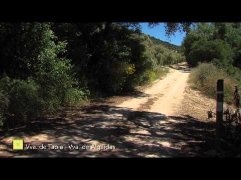
Stage 14 connects the two villages in a straight line running east-west, interrupted in the middle by a wide arc to the south, with a long stretch along the Arroyo del Bebedero stream. The starting point is about 50 metres higher than the finish, while the route climbs to almost 900m above sea level. As a result, there is a significant cumulative drop however, this is not a major obstacle. It crosses over the municipal borders of the two Villanuevas several times, although it runs beside the Arroyo del Bebedero for three and a half kilometres through the area belonging to Archidona. Almost the entire route uses the network of agricultural unsurfaced tracks.
At the start, the Path bypasses the Sierra del Pedroso, brushing past its northern edge in the process. A long section continues through hills of Olive groves with traditional farmhouses, reaching the highest point of the day, before linking up with the MA-5100 road. Then, along the bottom of the valley, it follows the course of the Bebedero stream for several kilometres, gradually curving to the northwest. Passing through the area of Malabrigo, it starts to climb out of the bottom of the valley to then return sharply to the west. It makes contact with the Camino del AlbaicÌn, very close to the end of the stage.
The Sierra del Pedroso stands out in satellite images like an island, due to its very clearly defined boundary and being a significant ridge with its summit at 1,024m. Surrounded by a sea of Olive trees, the karstic ridge itself is covered by dense Mediterranean shrubs and Holm oaks. In addition, it appears to be attempting to reconquer its surroundings with its large Oak trees and Dehesa pastures mixing in with the crops.
The Bebedero stream can be considered another type of island, in this case linear, sustaining rich vegetation with its clean waters. The valley is in the Rond·n region and boasts substantial woodland, preserved thanks to the extreme gradient of both its eastern and western valley sides.
The best
The Sierra of el Pedroso shows in satellite photos as an island of much defined boundaries, a high promontory of 1,023 metres of elevation. In a sea of olive trees, the karstic massif occupied by a dense Mediterranean scrub with Holm oaks seems to want to re-conquer the outskirts ahead with grand old oaks proportions and areas of dehesas between crops.
The Arroyo de Bebedero is another type of island, a linear one, which maintains rich vegetation with its clean waters. In the valley, in the area of Rond·n, there is a good tree-lined, surface still standing because of growing on extremely steep slopes to the east and west.
This stream is very important to the Great Path of M·laga because it will also be a hero of the beginning and the end of stage 15, under the shared name of Arroyo or RÌo de Burriana, (depending who you ask).