Itinerary
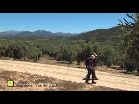
The path goes along undulating farming region, where the landscape is composed by the patchwork of olive trees, cereals, and oak forest with meadows, and ranches that speckle this monotonous scenery.
Summary
Stage 13 is a fairly leisurely route between two villages at the same height and with no large valleys in between hence, the slopes along the pathway are very gentle overall and never very long. The route crosses from one municipality to the next just before crossing the A-333 road to Salinas. Almost the entire section uses different types of tracks, which in general, are kept in good condition thanks to the high volume of agricultural traffic in the region. It passes underneath both the highway and the AVE high-speed railway line, and over the Bobadilla-Granada railway line by a level crossing without barriers.
The route takes a north-easterly course, between some low mountain ranges on the left and hills covered in Holm oak and Dehesa pastures on the right. The majority of this Dehesa land along the route is well maintained and has even been regenerated in places. It is a fine example of a harmonious relationship, both past and present between a natural landscape and human exploitation of natural resources for development.
The Great Path uses two traditional pathways that are designed perfectly for maximum ease of use, despite having to converge in their detour to pass underneath the motorway and the railway line. These much-loved routes form part of the local fabric of the surrounding villages. By following the Arroyo de la Negra upstream, the route introduces you to one of the tributaries to the valley of La Hoz de Marķn, and so complementing the previous stage.
Very close to the town of Villanueva de Tapia is the historically symbolic spot named El Trifinio, where the three provinces of Malaga, Granada and Cordoba meet. It is easy to imagine the controversies that would have arisen in these parts, up until the provincial boundaries were settled in the early nineteenth century. The Trifinio marker is where the Arroyo de la Cerca joins the Valholgado ravine to form the Arroyo del Cerezo, just to the east of the village and very close to the pathway.
The best
The two traditional paths, united somewhat artificially for the sake of the motorway and the train line are two examples of traditional infrastructure of impeccable path, part of the common heritage of the villages. The star of this Stage is without doubt the dehesas of Mįlaga’s north-eastern region, one of whose better spots are grouped around the above-mentioned communication channels.
Following the Arroyo de la Negra upstream, acquaints the walker with one of the streams that forms the Hoz de Marin, this Stage complements the previous one. From an historical point of view, the Trifinio is an emblematic place near to Villanueva de Tapia. In this location three provinces meet; Mįlaga, Granada and Cordoba, which gives an idea of the disputes unleashed in this area until the boundaries were set in the early nineteenth century.
The Trifinio cairn is where Arroyo de la Cerca joins with the Barranco del Valholgado to form the Arroyo del Cerezo (this name occurs at the beginning and end of this Stage), east of the town and very close to the trail.