Itinerary
This new path that is marked as 249.1, is a new alternative trail on stage 17 of the 249 Long-distance Path. It starts in Mollina and goes through the Sierra de la Camorra, where it connects the most important natural sites and farming areas in the towns of Mollina, Humilladero and Fuente de Piedra.
Summary
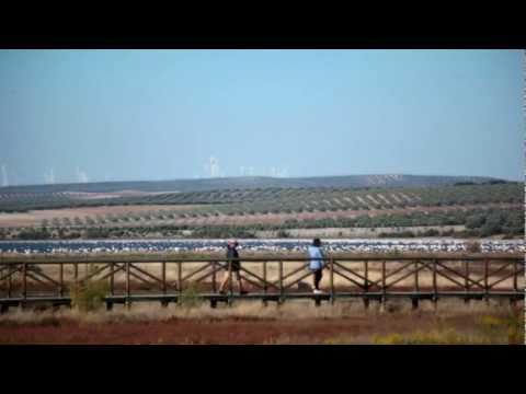
This interesting Alternative Route starts at kilometre 6.5 of Stage 17 of the Great Malaga Path, offering a second option to get to Fuente de Piedra. Instead of heading directly west from the Mollina mountain range, take this branch to the south at the junction between the Santill·n Pathway and the El PerezÛn Colorado Way. The route passes through the dry farmland of northern M·laga, and past three of natureís refuges along the way: the two mountain ranges of Mollina and Humilladero, and the Fuente de Piedra lake.
In general, the route has a very gentle downhill profile, with only one section that climbs up to the highest point in the Pine forest of the Sierra de Humilladero, close to the halfway point. It runs through the municipality of Mollina up until the quarry after roughly 7 kilometre. It then enters the municipality of Humilladero, which finishes just by the last houses in the town centre, where Fuente de Piedraís own land begins.
The stage goes south as far as Mollina, including through its streets, heading straight towards El Puntal de la Sierra. When you come to an aggregate quarry, the route heads westwards along the wooded slopes of the Sierra de Humilladero. It then continues through this second village in the same direction, parallel to the gentle valley of the CharcÛn stream. However, you twice meet the railway, which cut through these fields to link the Provinceís capital with the interior of the Peninsula. The high-speed train line is first, which you pass underneath, and the second signals the pathís final change of direction, this time to the north. The route reaches its conclusion at the village of Fuente de Piedra itself, since it links up with the original stage 17 at the central fountain and accompanies it to the Natural Reserve of the lake.
The whitewashed Andalusian villages on the route are exceptionally charming. Their churches stand out most, along with the network of streets, some small palaces and the manor houses, known locally as caserÌas, scattered throughout the countryside.
The best
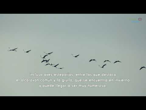
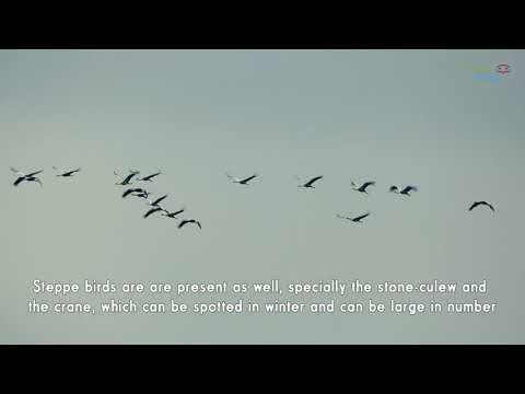
The Sierra de la Camorra is a high rocky piece of land in the hollow of Antequera, with varied old roads and some currently used ways. Alameda is the closest town to the above reserve that is characterized by biodiversity, and Mollina and Humilladero are nearby the Sierra de Humilladero. The landscape that surrounds the way to Mollina and past Humilladero, has changed little since old times. It is mainly composed of olive trees, cereal fields and vineyards. At some moments, the maze of these crops makes incredible scenery decorated by farming activities.
The line between the olive grove and the pine forest is probably the most attractive feature of this landscape. The coexistence of them probably brought difficulties in the past, but it is stable now. Reforested pine forests can be seen within several kilometre radius along the stage. Although the forest is rather dense, there is Mediterranean thicket in some open areas or at its borderlines. It consists of many different species, above all, the rosemary, esparto, rockrose and broom. Sometimes you can see dots of kermes oaks, followed by oak forest. Bellow Aleppo pines, some wild olive trees can be seen as they can adapt well to this kind of terrain.
Urban areas are rather important on this trail, above all churches and narrow streets in white Andausian villages, as well as mansions, large traditional houses or country houses which are scattered round the fields.